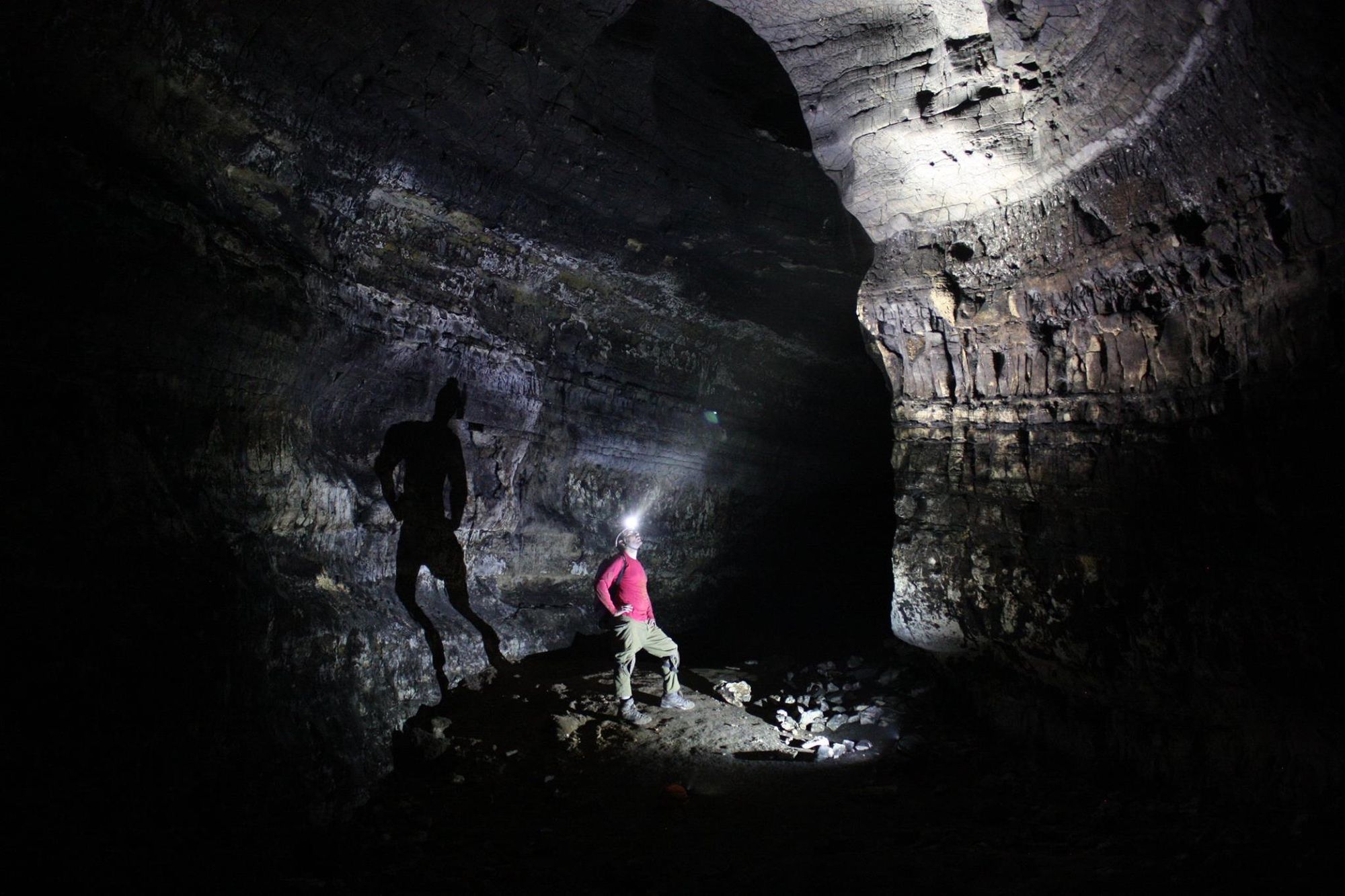
Tur a-Tzafa Cave
- Grid ref.
- 154160/110073
- Location
- Nahal Netziv
- Elevation
- 628 m above sea level
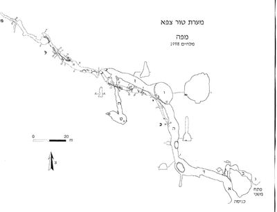 Cave mapView the map (PDF)
Description of the Cave:
General:
Tur a-Tzafa Cave is a large cave (total length 441 m) that developed by phreatic-hypogenic dissolution processes, in dolomite and calcareous dolomite of Cenomanian age (Kisalon Formation).
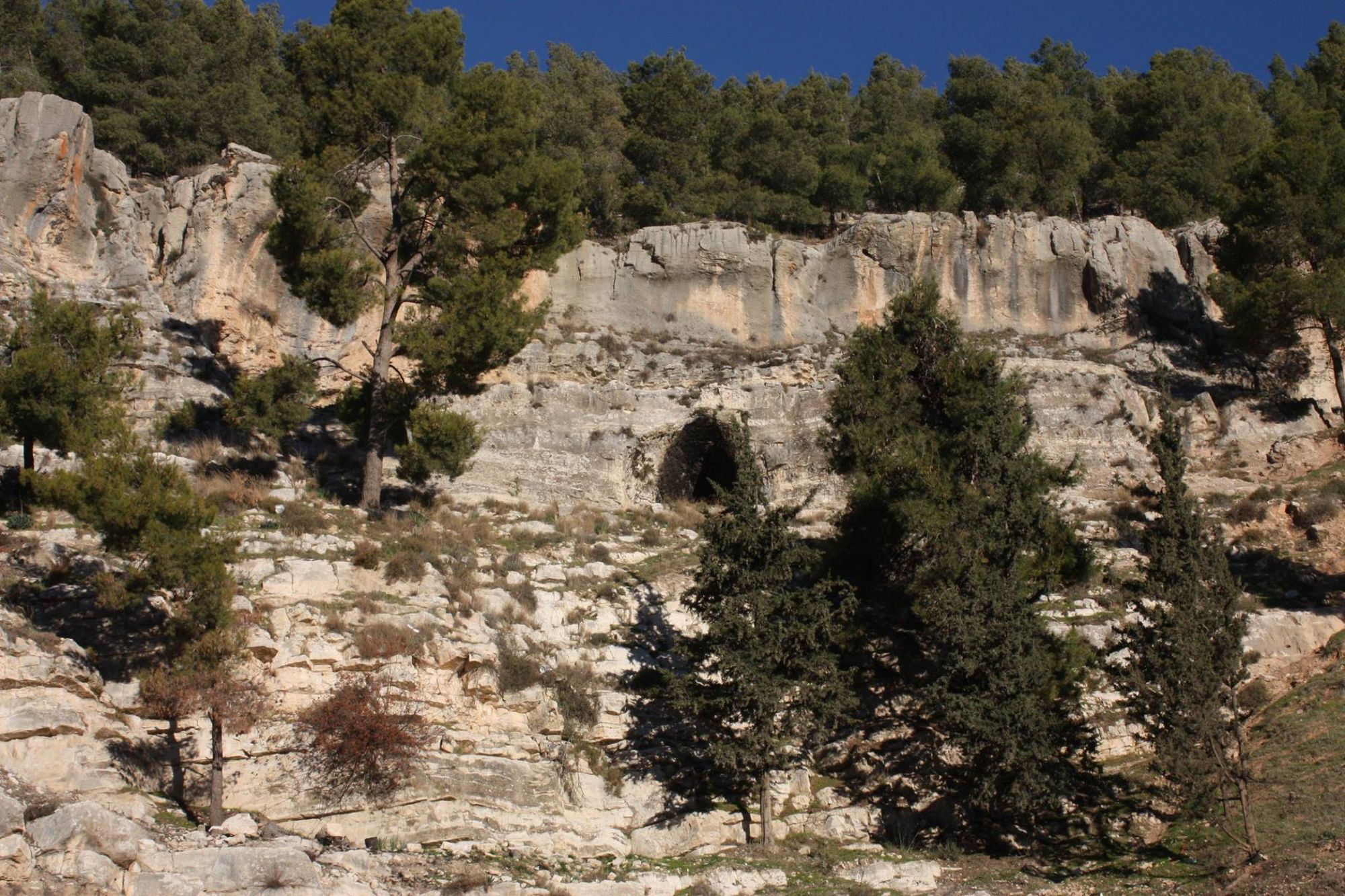
The cave is located in a steep cliff above the western bank of Wadi Itzha, on the western limb of the Hebron Anticline, where the rocks of the Judea Group dip 20 degrees toward the west-northwest. The general direction of the long axis of the cave is west-northwest, following the dip of the strata. The length of the cave is 441 m, and it is the largest of the caves of the western slopes of the mountain in Israel and the largest in Israel in the Kisalon Formation. Despite its remoteness and its location in the heart of an Arab area, the cave was known to Jewish hikers from the circles of Jerusalem wanderers even before the founding of the state. After the Six-Day War, field school instructors from Kfar Etzion visited the place from time to time, and it received initial documentation. The cave was studied and documented in greater depth in 1985 and later in 1998 by David Amit and Amos Frumkin. Until the latest discoveries in Abud Cave and in the Twins Cave, Tur a-Tzafa Cave was the only known refuge cave outside the Judean Desert and the desert fringe.
The Geology of the Cave:
The Kisalon Formation has two members in this area: the lower member is well bedded with flint lenses, and the upper member is massive.
On the surface the lower member mainly forms a steep slope, while the upper part of the bedded member together with the massive member forms a prominent cliff.
The cave consists of two main levels. The upper level is discordant to the strata - it passes from the bedded member in the entrance area to the massive member in its inner part. This level consists of a passage of large dimensions, reaching in Chamber 1 dimensions of 11x13x15 m. A secondary passage (B on the map) branches off near the entrance and reaches another, high opening of the cave (C).
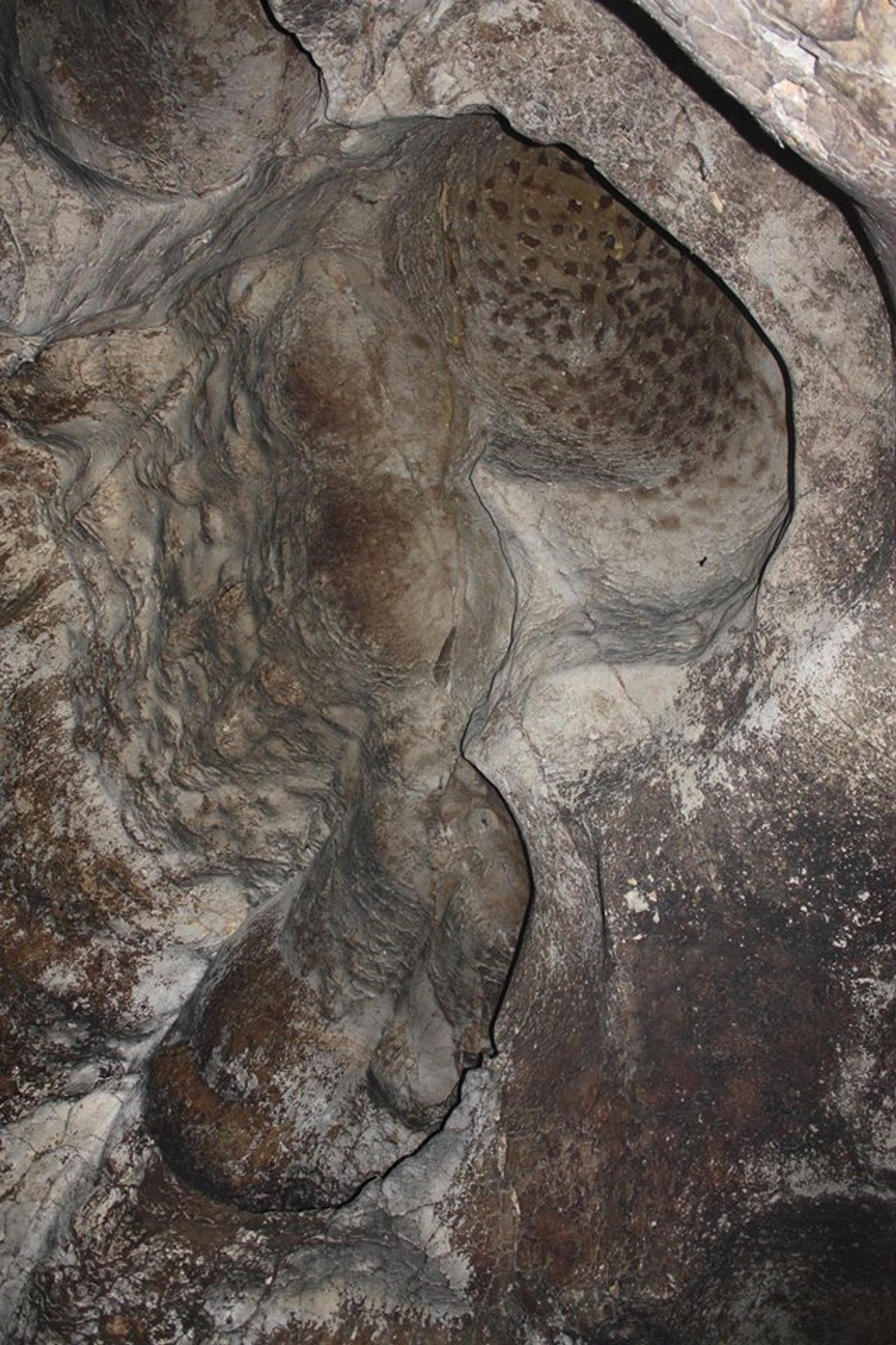
The upper level developed along two main joint systems, oriented 352 degrees (sections A, C, E, H) and 277 degrees (sections B, D, G, I). The upper level has rounded dissolution domes and smoothed walls, which indicate that when it was formed the cave was full of water. There are no signs of water penetration in the ceiling and it appears that the water entered from below or from the side under artesian conditions typical of the margins of anticlines. These conditions prevailed at the level of the cave during the Neogene, before the uplift of the mountain platform.
The lower level of the cave developed entirely in the bedded member of the Kisalon Formation, along bedding planes in the direction of the dip of the strata, and only a marginal influence of joint planes is evident. This level consists of a relatively narrow passage with local development of a system of parallel passages. In its eastern part the lower level developed parallel to section E-G of the upper level. The entrance to this level is from the floor of Chamber F, the central chamber of the cave. The morphology of the lower level hints at development under phreatic conditions with flow in the direction of the dip of the strata toward a drainage base that developed in the west.
It therefore appears that the lower level is later in its development than the upper level, and represents the end of the artesian stage in the history of the cave. According to this reconstruction, the cave represents two stages in the paleohydrological development of the Hebron Anticline.
On the cave floor a fill of soil, guano (bat droppings) and stones has accumulated to a height
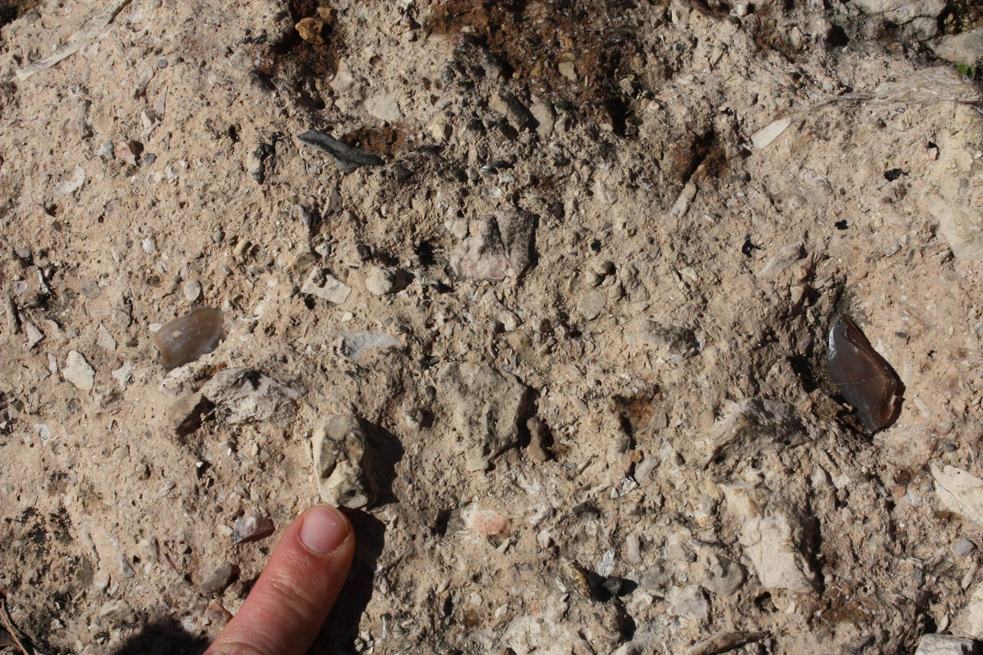
of two meters and more. At the cave entrance the fill hardened in a calcite matrix, and it includes prehistoric finds there. The cave itself is poor in chemical deposits (speleothems).
The Archaeology of the Cave
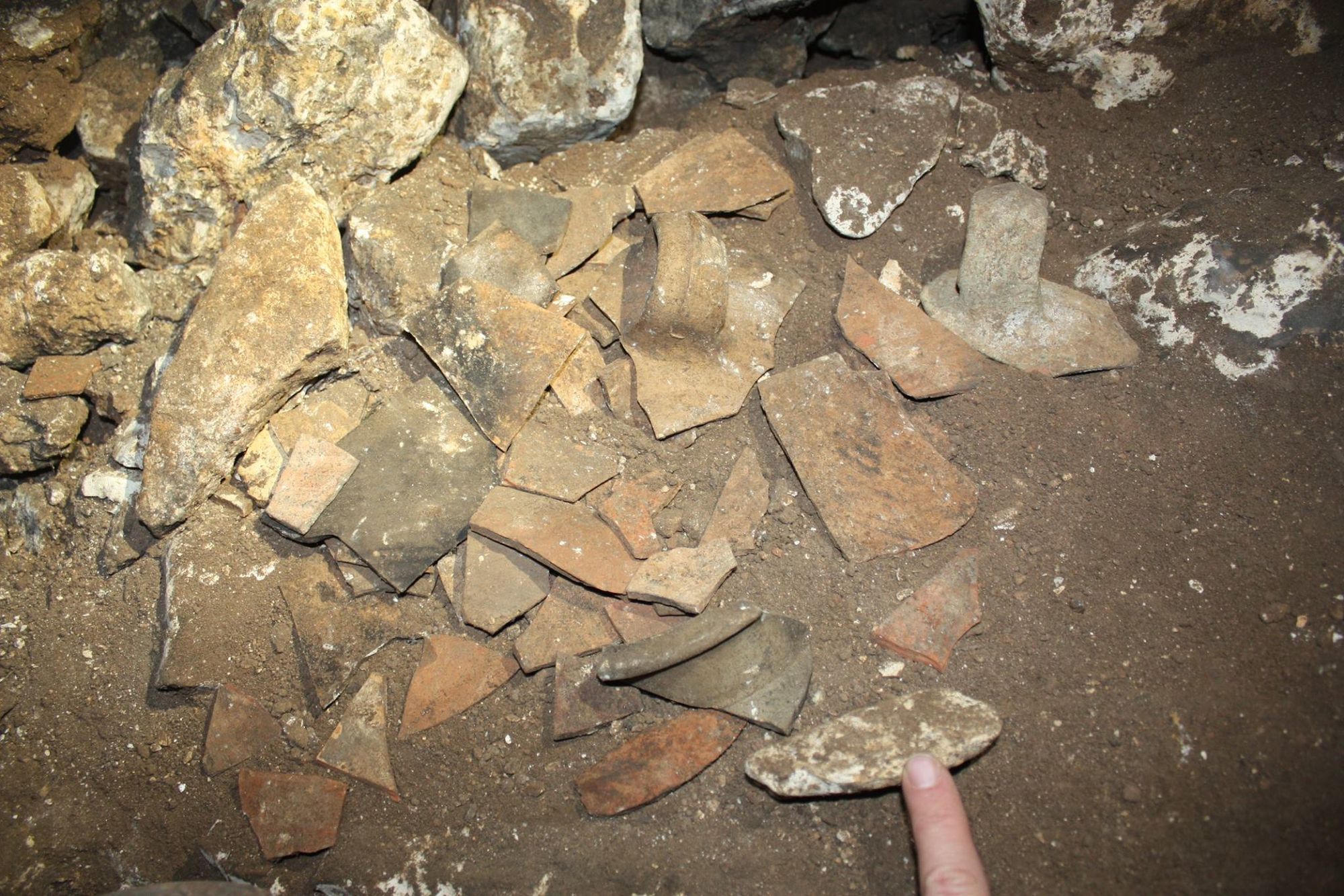
At the cave entrance there is an accumulation of breccia containing tool fragments and flint debitage characteristic of the Mousterian culture, which indicate activity at the site in the Middle Paleolithic period (50-200 thousand years ago). Among the few potsherds found in the cave passages are several fragments from the Chalcolithic period, but most of the potsherds discovered are fragments of jars from the Early Roman period. According to the testimony of an Arab from one of the villages near the cave, who specialized in finding coins with a metal detector and acquired proven experience in identifying them, more than 25 Bar Kokhba coins of various denominations were found in the cave.
Despite the scarcity of the ceramic finds and the doubt regarding the numismatic information, it can be assumed that the cave
was used by the Bar Kokhba rebels at some stage during the revolt - as a hideout during it, or (as is more likely) as a refuge at its end. This adds a new, though modest, point to the map of Bar Kokhba revolt sites.
Notes:
- Reaching the cave is dangerous from a security standpoint and requires military coordination.
- The cave entrance can be reached on foot from Camp Telem.
- On the upper level of the cave, dozens to hundreds of fruit bats were observed, which are the source of the guano. On the lower level, individual insectivorous bats were observed.
- Potsherds scattered in all parts of the cave were dated to the Early Roman period. Some of the Early Roman potsherds fit the period of the Bar Kokhba revolt.
- In all parts of the cave there are many looters' digs, soot remains and graffiti in Arabic
Edited by Yoav Negev, from:
Tur-Tzafa Cave: A Refuge Cave from the Days of the Bar Kokhba Revolt in the Western Hebron Mountains, David Amit and Amos Frumkin