Hermon Caves Survey - General Background
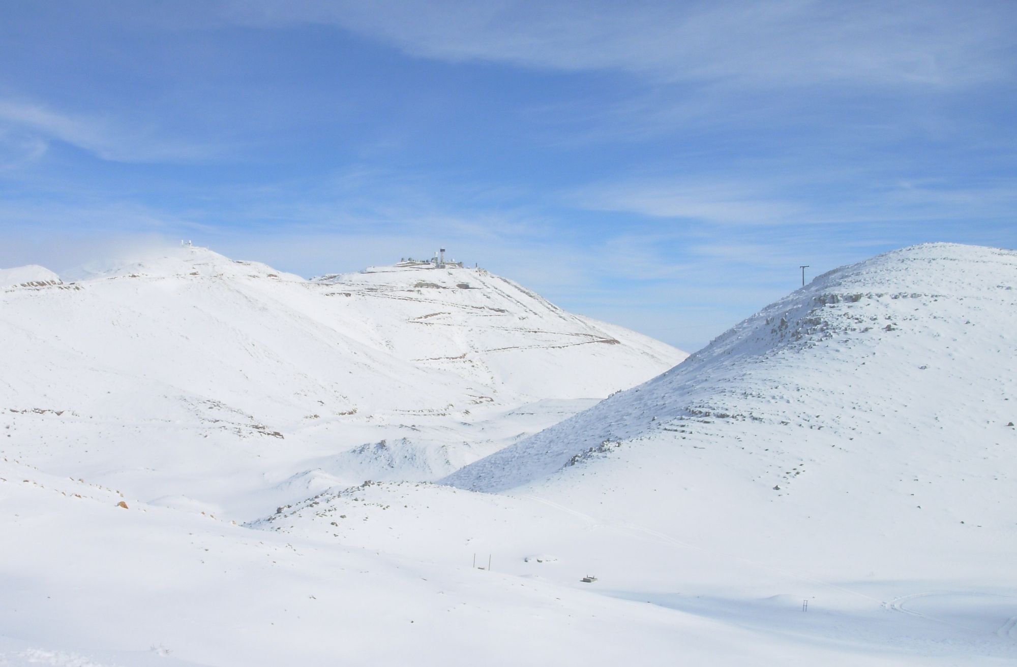
The high Hermon after the first snowfalls. Photo: Vladimir Boslov.
Introduction :
Mount Hermon is an area of alpine character whose maximum height within the State of Israel reaches 2236 meters above sea level. In the Mount Hermon area hard limestone, a high amount of precipitation and great height above sea level come together. These conditions create a clear possibility for the formation of diverse karstic caves.
Since the first Mount Hermon survey ended in 1990, the difficulties of returning to it increased for security reasons. The strong desire to reach the heights of Hermon was a kind of dream for every cave enthusiast, which could not be realized. The opportunity to reach the mountain for the sake of exploring its caves, thanks to the goodwill of the Hermon Brigade and the Northern District of the Nature and Parks Authority, which came our way, led to this compilation. The Mount Hermon survey is the fruit of the work of a small group of cave enthusiasts of the Land of Israel and was carried out in a manner in which field work was given the central stage.
Background to the Survey:
This survey was carried out by the team of the Center for Cave Information and Research (ICRC) with the help of additional volunteers, coordinated by Vladimir Boslov, and was conducted continuously between 6.8.08 and 11.12.08.
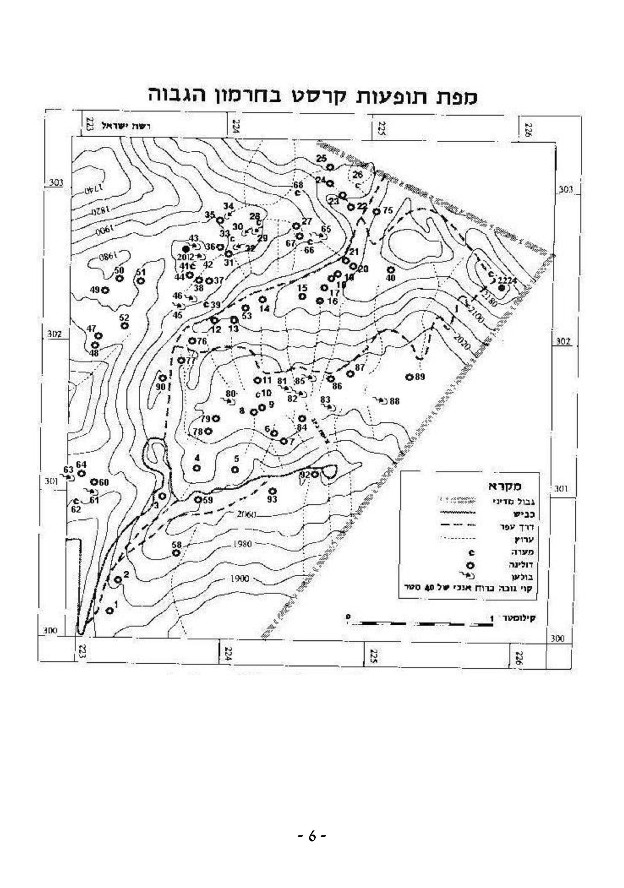
During the survey an extensive area on Mount Hermon was surveyed in order to locate and mark prominent karst features.
During the survey more than 150 dolines, caves, shafts and karstic pits were found and surveyed, and the lion's share of the karst features from the Hermon survey carried out by the ICRC in the late 1980s was re-examined. That survey was published in the journal Nikrot Tzurim (Nikrot Tzurim, 16, Nisan 5750, April 1990). The total of karst features described in that booklet stands at about 190 karstic features of various types discovered in the area of the Hermon anticline.
The karstic spaces found in the new survey were mapped, and corrections that were required in the plans from the previous survey were also made.
It seems that in the area west of Nahal Si'on there is a high potential for the discovery of additional karst sites. For security reasons its complete scanning was not possible, and it was surveyed by us only partially and in a limited manner.
The working method by which the karst features were discovered was:
Foot scanning of places with potential for the presence of karstic spaces in the mountain area (dolines, cliffs, etc.), locating the features, and documenting them (by reporting and mapping). During the survey various types of underground spaces were discovered: dolines, sinkholes, shafts, karstic pits and chimneys.
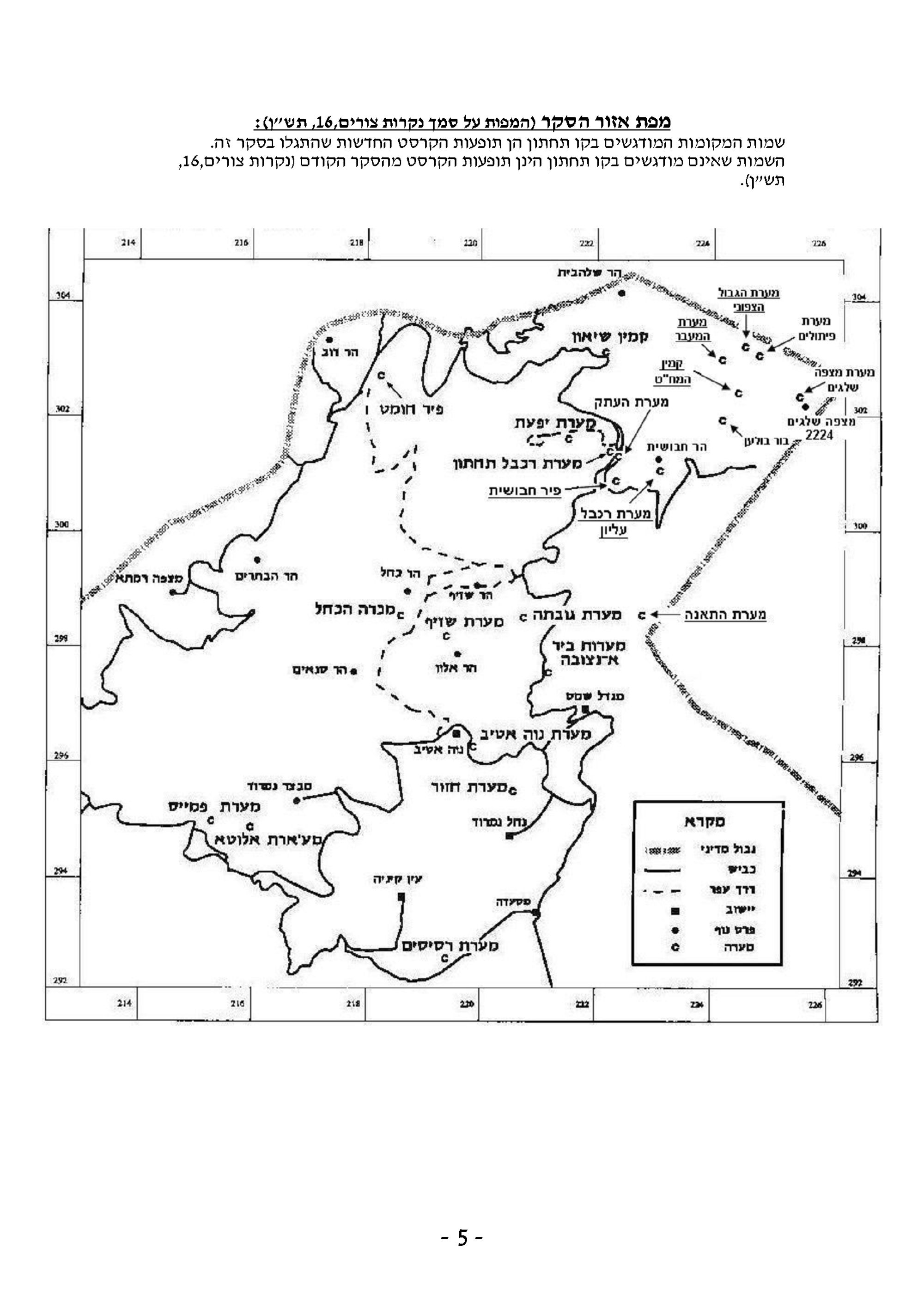
Map of the Survey Area (the maps are based on Nikrot Tzurim, 16, 5750):
The names of places underlined are the new karst features discovered in this survey.
The names that are not underlined are karst features from the first Mount Hermon caves survey (Nikrot Tzurim, 16, 5750).