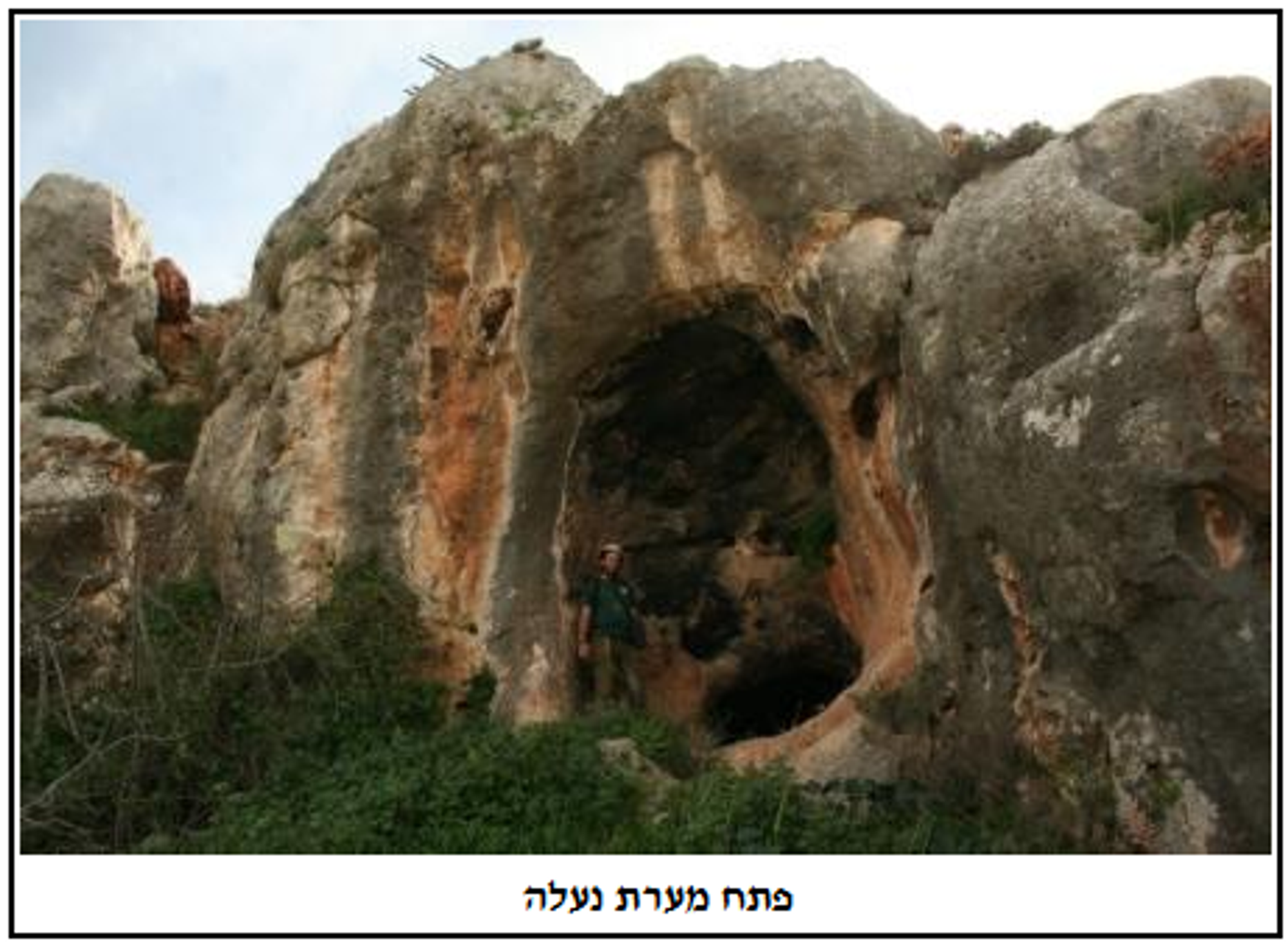
Naale Cave, Southern Samaria
- Grid ref.
- 156732/152566
- Location
- Within the boundaries of the community of Naale
- Elevation
- 429 m above sea level
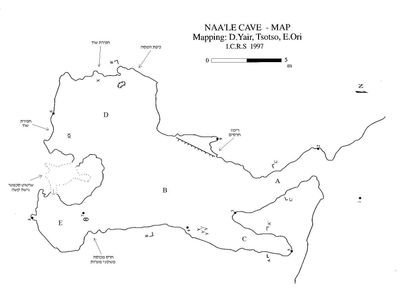 Cave mapView the map (PDF)
Description of the Cave:
Naale Cave is a horizontal cave, medium in size (total length 55 m), that developed in Upper Cenomanian limestone (Vradim Fm.). The cave is located in the middle of a low cliff, at the top of the northern bank of Wadi Khader (a short channel descending in an east-west direction and draining at its end into Nahal Netuf). The cave entrance is rounded and large but nevertheless does not stand out from afar - due to the direction of development of the passage leading into the cave, which creates a picture in which the cliff looks like a continuous wall and not one in which a dark opening gapes. The entrance measures 1.6X1.5 m and from it a wide passage (A) extends about 6 m to the southeast. At its end the passage connects to an elongated, spacious chamber (B) whose axis is north-south.
Description of the Chamber:
This is a spacious chamber (the center of the chamber measures 11X6 m and its typical height is 1.5 m) that is divided into various wings that will be described below. The chamber floor is covered with yellowish sand, a product of the weathering of the cave ceiling and walls - in which prominent signs of phreatic dissolution are evident, in the form of dissolution domes, dissolution niches and smoothed walls. Entry to the chamber is through the passage described above (passage A), which connects to the chamber at its northwest corner. At the junction of the passage, adjacent to the western wall of the chamber, there is a natural rock ledge around which many potsherds are scattered (potsherds are scattered throughout the cave space, but at this point there is a prominent concentration). On the other side of the chamber, east of the ledge described, there are a few stalactites dripping from the cave ceiling to its floor, so that beneath them conulites formed, on which tiny pool deposits were deposited. North of the stalactites a short passage extends north (C), 4.5 m long, with a rounded cross-section.
At its southern end the chamber splits into two wings: western (D) and eastern (E). The eastern wing is the larger of the two, measuring about 7X5 m, its general shape is rounded, and in its ceiling there is a well-developed dissolution dome creating a point where the ceiling height reaches 3.5 m. At the time of the cave mapping (Y. Natan, A. Y. Eitam, A. Tzoar - ICRC 1997) the mappers found three looters' pits in this wing. On the eastern side of this wing there are narrow openings leading to an extremely low space extending east until its connection to the eastern wing of the chamber - wing E. This wing is similar in shape to the western wing but half its size. On the floor of the northern side of this wing the cave mapping team found a potsherd on which a cave-deposit coating 2-3 mm thick had been deposited.
A report dated 8/7/1987 stated that "during a tour with Yuval Amir (Staff Officer for Archaeology of Samaria), potsherds were collected by him and dated to the Roman-Byzantine period. This report was delivered orally to Asaf Tzoar.
Access and Hiking:
Access to the cave entrance is not problematic. It can be reached via the Ma'arechet road of the community of Naale.
* During the visit to the cave (2010) no bats were seen in it. During the mapping of the cave (1997) a single individual of a pygmy mouse-tailed bat was seen in it.
Written by: Boaz Langford