Jermak Shaft
- Grid ref.
- 18800/26594
- Location
- Mount Meron
- Elevation
- 1060 m above sea level
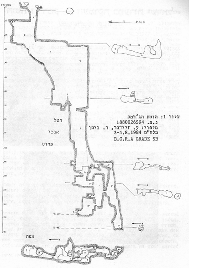 Cave mapView the map (PDF)
Cave description:
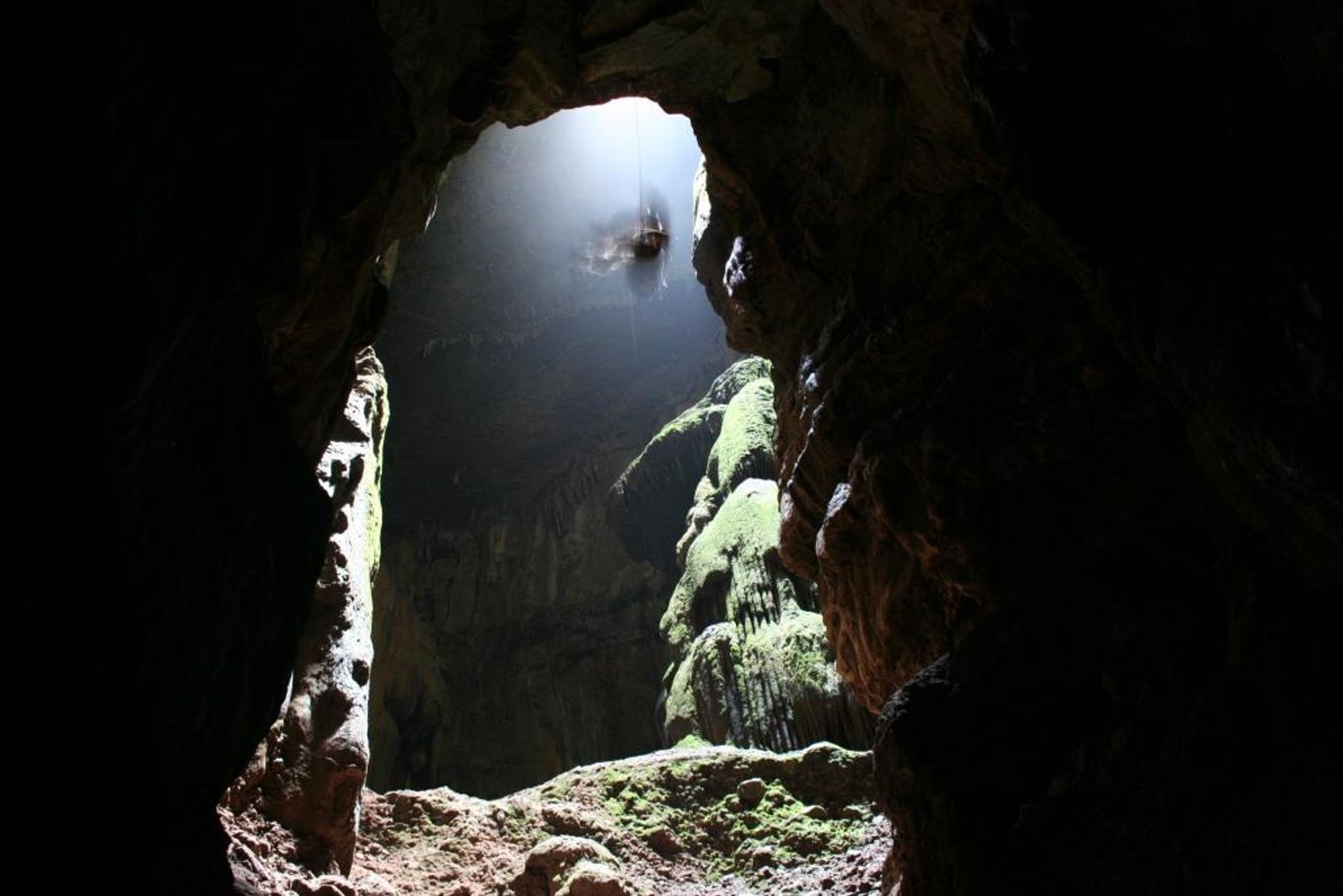
Jermak Shaft is located in the lower member of the Deir Hanna Formation of Cenomanian age (the Hamima Formation in Eliezri, 1959). The rock is mainly bedded dolomite, partly chalk-like with chert nodules. Thin marl horizons occasionally appear between the dolomite beds. 118 m above the base of the formation there is a horizon of quartz geodes, known as "Elijah's watermelons" (Bein, 1967). At a depth of 26 m, on the "balcony" in Jermak Shaft, we found (A.Z.) quartz geodes that remained after the surrounding dolomite was dissolved. They probably originate from the above-mentioned horizon. According to this stratigraphic marker, the lower part of Jermak Shaft penetrates the Kamon dolomite formation.
Most of the shaft is developed in rock that is not notable for high hydraulic conductivity, and it is defined as an aquitard (Bein, 1967). The upper member of the Deir Hanna Formation, which appears above the shaft entrance, is chalky and aquiclude in character; it should therefore not be assumed that the shaft was developed at a great height above the present entrance, in periods when the land surface was higher. In contrast, at the bottom of the shaft there is no rock layer that prevents its further development. The shaft can therefore develop to a depth of about 80 m more, down to the base of the dolomite of the Parod Member in the Kamon Formation.
The semi-chalky nature of the rocks of the Deir Hanna Formation generally prevents the development of karst phenomena in them.
The land surface in the Mount Meron massif also betrays this fact: there are few rocky outcrops and most of the area is covered with soil. Most of the large caves in the Galilee developed in the rocks of the Sakhnin and Bi'ina formations.
The shaft is located about one kilometer west of the axis of the Meron anticline, which is also the geological watershed line of the
region (Bein, 1967). The dip of the strata here is small, about 2° to the northwest. Because the shaft is close to the axis of the anticline, it has no large underground drainage basin, and it should therefore not be assumed that it was formed by phreatic (groundwater) dissolution. The water that created the shaft therefore originates in precipitation falling on the surface in the immediate vicinity.
Why did such a deep and complex karst pit develop in a host rock that is not ideal for karst development? The reason is probably the developed fracture system at the site. Jermak Shaft developed mainly along a fracture system whose strike direction is 185°. Most of the horizontal development of the shaft took place from north to south, along the fracture lines (see map), and the same happened to its vertical development. This fracture served as a primary conduit that passed through the whole lower member of the Deir Hanna Formation. The rock layers, with low hydraulic conductivity, created perched water horizons around the shaft, and these drained water into the fracture, which became a central drain in its surroundings. The water-bearing layers that drained into the fracture caused a certain horizontal development of the shaft space, in addition to the vertical development that took place down the fracture. Thus, inside the shaft, at a depth of 10 m and at a depth of 25 m, one finds a horizontal level of flat ceiling that follows the bedding plane. This phenomenon is generally rare in chimneys; their shape is usually that of a cone whose upper tip is pointed. Despite the special horizontal development, Jermak
Shaft is built mainly of vertical chimneys. A chimney is a typical phenomenon of vadose karst (Frumkin, 1984). Chimneys are formed by the flow of a film of aggressive water on the walls of fractures, which widens them. The Jermak shaft is built of a system of eight interconnected chimneys. On the basis of the morphological structure, three main stages of formation of the shaft can be distinguished, and an additional stage of filling and deposition.
In the initial stage of the shaft's existence, chimneys 1, 4, 7, 13 and 14 were formed. A stepped structure typical of a vadose system was formed, made up of vertical segments (chimneys) and horizontal segments (narrow passages). Over time the dissolution process advanced and created headward erosion of the shaft, a process similar in nature to the retreat of waterfalls in surface streams. This process is especially prominent in the upper parts of the shaft, down to a depth of 70 m. This retreat reached its peak at a depth of 30 m below the surface. Here the flow took place, in the initial stage, close to the southern wall of chimney 4, and in the third stage the flow line migrated to the northern wall of chimney 3, a distance of 40 m from the original flow line! The migration of the flow line here took place along the main fracture of the cave. The space that was formed is a vadose canyon, identified as a structure typical of a retreating waterfall.
In the lower parts of Jermak Shaft, from a depth of 120 m downward, the flow line migrated in the following manner: here the flow was captured from time to time into a new, preferred route, and the previous flow path was abandoned. In the first stage the water flowed through passage 12 to chimneys 13 and 14. In the second stage chimney 7 was deepened, and at its bottom the water found a new outlet to chimney 8. From there the water flowed through corridor 9 to chimney 10, and from it through a narrow passage to chimney 13 and back to the original route, to chimney 14. In the third stage
chimney 10 deepened, and the water found an outlet at its bottom, through a narrow fracture, to chamber 11. Here the water is found today on the floor of the chamber.
During the stages described above, the shaft continued to develop. That is, the volume of the space grew through the process of rock dissolution by aggressive flowing water. Today the opposite process is taking place inside the shaft: seepage water saturated with solute deposits travertine. This process probably began to occur while the shaft was developing, in parallel with growth by aggressive water. The two processes can occur simultaneously, provided that two types of water are supplied: flowing water rich in CO2 and poor in solute, and seepage water saturated with carbonate solute. Most of the water flowing into the shaft today does not enter it through the entrance, but through its walls, from the surrounding rocks. At the bottom of the shaft the water penetrates into the Parod aquifer of the Kamon Formation.
It has not yet been proven where the water finally emerges. In any case, given the structure of the shaft, it is hard to assume that a flute that fell into it could come out of the Peki'in spring (as the legend claims). The seepage water deposited travertine in various and diverse forms in Jermak Shaft.
Notes:
- The enormous variety of forms has hardly an equal in other caves in Israel. There are flowstone sheets, stalactites, stalagmites, pagodas, elephant ears, pool deposits, helictites and cave coral. We also found cave pearls (Cave pearls) in the cave, a rare cave deposit that was discovered here for the first time in Israel! The nearest place to us where cave pearls have been discovered so far is Qasarat Cave, northeast of Beirut in Lebanon (Middleton, 1970). Cave pearls are a protected natural asset (like all other cave deposits) and it is strictly forbidden to harm them in any way.
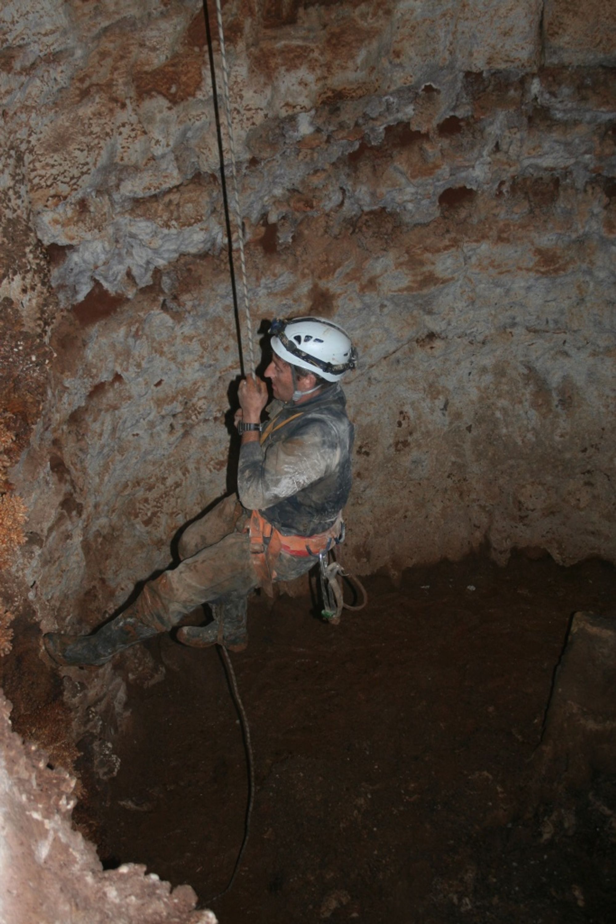
- Jermak Shaft is extremely dangerous for anyone who is not qualified and experienced in S.R.T. techniques (climbing and rappelling). The complicated structure of the shaft and its great depth mean that rescuing casualties from it is a difficult and prolonged operation. Accidents there may cost human lives. It is therefore strictly forbidden to descend into the shaft without good command of the techniques and suitable equipment. Any rescue operation from the shaft will be at the expense (pocket) of those rescued.
- The shaft is located within the Mount Meron Nature Reserve, and it is forbidden to descend into it without permission from the Nature Reserves Authority.
From: Nikrot Tzurim, Booklet No. 10