Arbel, Cave Complex West of the Fortress
- Elevation
- 85 m above sea level
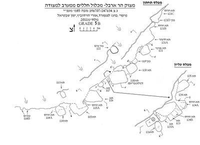 Cave mapView the map (PDF)
Description of the Complex:
General:
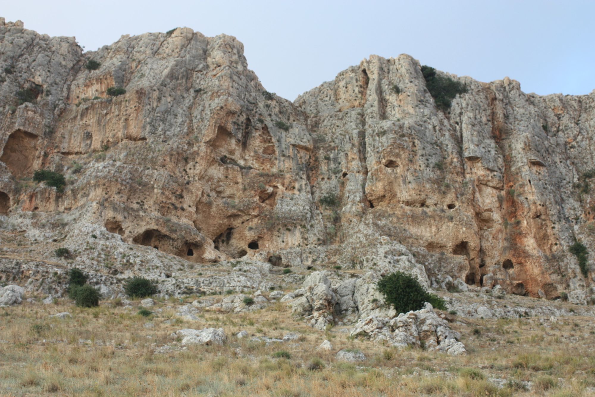
The complex of spaces described consists of about 20 extant spaces and several destroyed spaces, spread over about 85 m, on several levels, at the base of the upper cliff of Mount Arbel, west of the Ibn Ma'an Fortress. Several spaces, including a plastered water cistern and two rock-cut cells, open at the head of the slope, below the base of the cliff, and are directly related to the complex; two of them have been documented and one has not yet been documented.
Lower Level:
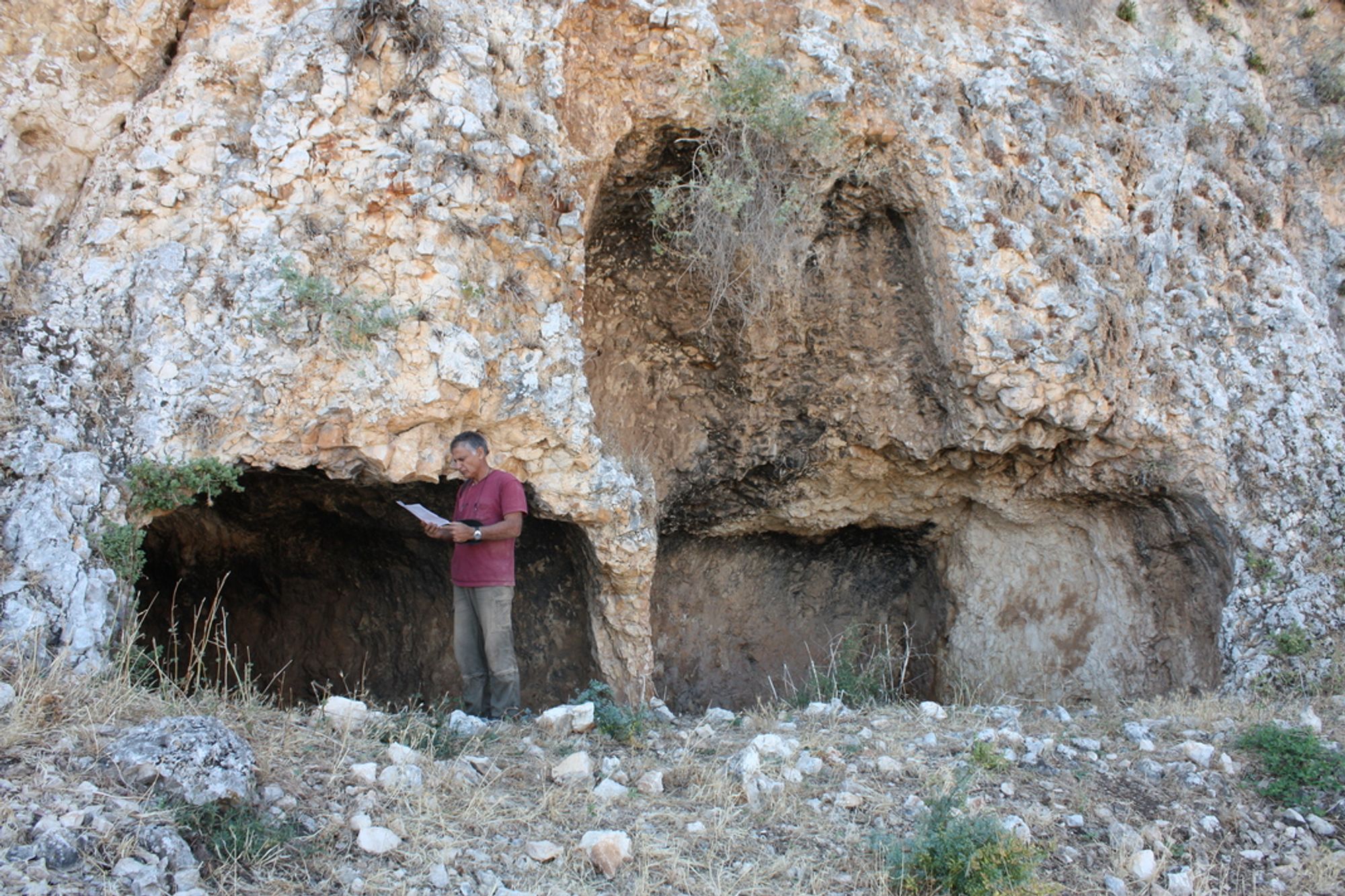
The easternmost space in this complex is space 121. This space consists of a single room (measuring 2X1.5 m) with a well-shaped entrance that looks like a rectangular door, with an outer threshold raised 0.25 m above the inner part of the room. In the outer part of space 121 there is a rock-cut vestibule (A121) that looks like the remnant of a large space that was once there. East of the vestibule there are remains of two rock-cut cells (B121 and C121). Of these cells the outline of the walls and a very small part of the floor survive. Passage between the two cells is possible by means of a narrow step about a meter high, divided in its center into different levels.
West of vestibule A121 there is another roofed area in whose inner part two spaces are cut: niche 119 and cell 120. Niche 119 consists of an open space with a square outline, cut into the base of the wall. About a meter above it and adjacent to it there is a stylized trapezoidal opening leading to cell 120. This is a well-preserved square cell with a horizontal floor covered by a very thin accumulation layer.
The entire space described, from the eastern end of the cliff to the area of the entrance of cell 120, is bounded on the north by a rock step separating the complex from the slope of Mount Arbel below it. From the area of cell 120 westward similar rock steps continue, but they are somewhat farther from the base of the complex's cliff, so that a sloping area is created from the entrances of the complex northward. North of cell 120, in one of these rock steps, a rounded space with plastered walls (water cistern 122) is cut, now blocked by heavy cliff weathering debris. It seems that this space (and perhaps also another plastered space cut west of the complex) served as the water reservoir of the inhabitants of the complex.
West of cell 120 a wide opening leads to a square space (cell 118) measuring 5X3.5 m and reaching a height of 5 m. The floor of the cell is horizontal and covered with a thick layer of soil; its ceiling is uneven and shows signs of weathering. The walls of the cell are vertical, and in the central and eastern ones 15 small niches are cut, in varying states of preservation. Judging by the shape of the niches and their arrangement in rows, this space is suspected to be a 'primitive' columbarium.
West of cell 118 there is a small, low space (cell/niche 117) whose floor is covered with a lot of slope weathering debris. Adjacent to this cell on the west there is a wide pair of spaces: cell 115 and cell 116. The entrances of these cells are destroyed, but most of the space of the cells is preserved, except for part of the wall that once separated them. The floor of the cells is covered with a thick layer of soil and their walls show significant signs of weathering. Above cell 115 there are remains of a destroyed cell (A115), of which mainly its walls and part of its ceiling survive.
A little west of cells 115 and 116 there is a clear opening leading to a well-preserved space (cell 114), measuring 3X2.5 m and 1.3 m high. Above this cell there are signs of the presence of another cell (A114) that was destroyed with the weathering of the cliff. A little west of cell 114 the cliff of Mount Arbel turns and continues to the northwest. After about 15 m the cliff turns west again and additional spaces (including a plastered water cistern), connected to another complex, are cut into it. Shortly before the turn of the cliff a pair of tiny spaces (B114) is cut in it, which look like a pair of destroyed cells.
North of space 114, on the slope, there is a low rock step in which a rectangular opening opens, leading to a small space (cell 113) measuring 1.3X2 m and 1.3 m high. The floor of the cell is covered with a lot of slope weathering debris. In the next low cliff step another cell is cut, which has not yet been documented. This cell is the lowest in the complex and marks its northern end.
Upper Step:
The upper step extends above the center of the lower step, so that the easternmost space on this step (cell 125) is located above cell 120. Above the east of the upper step the remains of many cells can be seen, extending over three additional levels hanging at the height of the cliff, with no access from below today, and in a very low state of preservation. Cell 125 looks like a square space whose northern part is open to the cliff face. From this cell a narrow, stepped rock ledge extends, connecting it with cell 124. These cells (125 and 124) are raised above the central space of this step - cell 123. Above cells 123-124 there is a pair of destroyed cells (A124 and B124), of which the outline of the walls and a little of the floor area survive.
Cell 123 consists of a large open space with a horizontal floor and a ceiling that covers only its southern and western part. In the western part of the cell space there is a remnant of a rock-cut wall that once divided the cell space into a pair of separate cells (the western one - A123). In the western ceiling of cell A123 there is a rounded opening leading upward to cell 126. This cell consists of a square central space that has another opening to the cliff face. In the center of the space a rounded, unplastered pit (B126) is cut. The depth of the pit is 1.8 m, the diameter of its opening is about 0.9 m, and it widens like a bell from its opening downward. South (C126) and west (A126) of the center of the space in which the pit is cut, there are small rooms branching off from the center of the space of cell 126.
Written by: Boaz Langford
For further reading, see the articles page Refuge, Hiding and Shelter Caves in the Galilee.
Site name: Complex of Spaces West of the Fortress
Central grid ref.: 196707/247634